

Introduction
Dotted around the parish of Casterton were sixteen lime kilns, eighteen if you count a twin kiln as two, some of which are still standing. Using old maps, field names that reference a kiln, archive newspaper listings of farm sales or tenancy agreements, documents in the Kendal Archives such as leases wills or estate papers, as well as, as far as possible, visiting the sites, this Sketch will review the history of Casterton’s lime kilns.
Notes on Sources
Source Maps
I have used several old maps to help identify old and existing kilns. The earliest map which included Casterton was one printed in 1760 called ‘A New Map of the Counties Cumberland and Westmoreland’. The map was engraved by Emanuel Bowen who, not being a cartographer, was not able to produce a map of great accuracy. With its scale of approximately 1:240,000 it was only detailed enough to show the location of the village.[1]
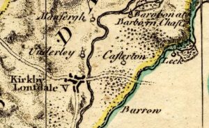
Extract of the 1760 map ‘A New Map of the Counties Cumberland and Westmoreland’.[2]
Estate Maps – C1800
Estate owners often had drawn up maps of their land for administrative purposes. It is fortunate that Casterton is represented with several such maps in the Kendal archives dating from C1800. The maps were drawn up by a local Surveyor John Todd for locations such as the areas around Fell Yeat, where the church now is, Casterton Hall and Hole House. John Todd is better known as the Kendal cartographer who produced the 1787 town plan of Kendal.
Enclosure Map – 1816
Another early map of the area was prepared in 1816 when some of the land in Casterton was enclosed. Casterton was very much following the trend in the country and especially in Westmorland. It has been estimated that by the late 18th century, about 80 percent of Westmorland was deemed upland waste and was unenclosed. This was soon to change. In Westmorland alone, there were 98 Enclosure Acts which permanently changed the landscape.[3]
Map expert William D. Shannon noted that between the mid 18th and 19th century the Cumbrian landscape was transformed. The open hill pastures that had been there for centuries were systematically transformed with the addition of a patchwork of long straight dry stone walls.[4] Shannon comments that most of the walls in Cumbria date from the mid 18th and 19th century and that they were built using newly quarried stones rather than those previously cleared from fields or retrieved from the county’s numerous becks.[5]
More details about the Casterton enclosures can be found in an earlier Sketch – see A sketch about the enclosures of Casterton Most of the newly enclosed land in Casterton was on the fells but some was also along the river Lune. The enclosure records recorded details about each ‘allotment’ i.e. field or parcel of land, which were to be enclosed or created. Each allotment was assigned an identification number with details that included who owned the land and the area of the field in acres, roods and perches (A R P).
Other features such as a quarries and farms were also included on the map, as were the new roads that were to be laid.
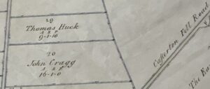
Detail of enclosure map showing the owners of fields 19 and 20, their area, and a new named road Casterton Fell Road.
In the Kendal Archives there are various versions of Casterton’s enclosure records and maps, after all the process took several years. Examples are included those noted in the footnote.[6]
1828 Map
A map of Westmorland surveyed between 1823 and 1825 by Thomas Hodgson shows the locations of kilns nestled between High and Low Casterton. These kilns are the ones south of Bee Nest Farm, also shown on the map. Note that the map records both Low Casterton and High Casterton.
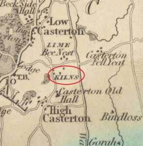
Extract of 1828 Hodgson map.
Tithe maps – 1843
Tithes date back to at least the time of King Ethelwulf (839 – 58). A tithe was a tax that demanded that one tenth of all agricultural produce should be paid annually to support the local church and clergy. Payment was usually made in kind by crops or livestock rather than in cash.
After the Reformation and the Dissolution of the Monasteries, large tracts of land passed from the Church to lay owners who, along with the land, inherited this entitlement to receive tithes. By the early 19th century payment of tithes in kind seemed a very out-of-date practice. Indeed, any payment of tithes per se became unpopular.
It was clear that this ancient tax system was falling apart and so the 1836 Tithe Commutation Act was introduced to bring the system up to date. The Act required tithes in kind to be converted to more convenient monetary payments called a tithe rent charge. Tithe surveys of parishes were commissioned to find out which parcels of land were subject to tithes, who owned them, how much was payable and to whom.[7] This required a very detailed field survey. In Westmorland, 85 tithe maps were produced covering 34 percent of the county, including Casterton.[8]
The Casterton tithe map and apportionment records can be found in the Kendal Archives.[9] Unlike the enclosure map, the tithe map included the whole of the parish of Casterton making it the first detailed parish map.
The tithe map and apportionment included details such as the field name, the area of the field, the owner and tenant of the field and other information such as properties. The identification numbers assigned to fields on the tithe map are different from those used in the enclosure map. Despite this, where they cover the same area, they can easily be cross referenced against each other.
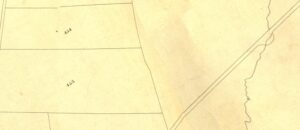
Detail of the 1843 tithe map showing the same field and road as the detail above of the 1816 enclosure map.
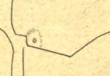
Example of how a lime kiln is recorded on the 1843 tithe map.
Ordnance Survey Map – OS Map
The Ordnance Survey is so-called because it was founded by the Board of Ordnance, the government department responsible for equipping the military. It was recognised that having accurate maps of the country would help the military in their defence of the realm.
The first map that Ordnance Survey published was of Kent in 1801. The plan was to document the whole of the UK using a scale of six inches to one mile. After around 20 years, about a third of England and Wales was mapped. It was not until 1870 that they managed to complete the entire first series of OS maps. Unsurprisingly, given the remoteness of Westmorland, the OS map which included Casterton was not published until 1862.
Annoyingly, the parish of Casterton was split across two maps. Each published map measured 36 x 24 inches and covered an area of 6 x 4 miles at a scale of six inches to one mile (1:10,560).[10]
The west of Casterton was documented as far east as the buildings dotted around the George and Dragon Inn (The Pheasant). This map was first surveyed in 1857, contour lines were surveyed in 1859, the map was engraved in 1861 and finally published on 16 October 1862.
The west side of the village was first surveyed in 1858, contour lines were surveyed in 1859, the map was engraved in 1861 and finally published on 31 July 1862. So, for about 2½ months, the villagers on the west of the village had boasting rights over those in the east!
Aerial Views
I have used Google Maps when looking at aerial views of the village.
LIDAR Imagery
Within this Sketch, I will be using some aerial LIDAR imagery to try to illustrate where the remains of the kilns are. LIDAR is an acronym which stands for LIght Detection And Ranging. LIDAR depicts the surface of the ground as a three-dimensional image, it is produced by measuring the distance to the ground of numerous laser beam pulses fired from an aircraft and converting this data into an image. It is used primarily for environmental purposes such as flood control, but archaeologists can also make use of the technology. In one mode, LIDAR creates a landscape image that removes all structures, trees and foliage. This enables archaeological features that would not be visible on an aerial photograph such as the agger of a Roman road running through woodland, to be identified.
Lime Burning and Lime Kilns in Westmorland
Historian David S. Johnson has comprehensively studied the history of the use of lime in Westmorland over the centuries. I have used his work to provide an overview of the history and to offer insight about our own lime kilns.[11]
Lime has been produced in Britain since at least as early as Roman times. In more recent times, records show that in the north of England lime kilns were becoming more widespread in the seventeenth century.
Westmorland appears to have been a late developer when it comes to lime kilns. Johnson writes that ‘In the case of Westmorland this came much later. In 1800 no less than 79 per cent of the land area of the county was classed as unproductive ‘waste’ compared to a national average of 21 per cent; by 1873 a third of all land in Westmorland was still regarded as unenclosed and unproductive.’[12]
The parishes of Westmorland are split between those in the Kendal Barony, in which Casterton falls, and the Westmorland Barony. In the Kendal Barony, there is evidence of 33 parishes containing a total of 192 Kilns, an average of just fewer than six kilns per parish.[13] Casterton is a small parish and therefore its 16 lime kilns are significantly higher than average. By comparison, other parishes with lime kilns included Barbon with seven kilns, Preston Richard with 5 and Kendal itself, with only 9.
Processing Lime
The production of lime requires as a starting point limestone. After the raw stone has been through the firing – or calcining – process, carbon dioxide and moisture are driven off leaving behind quicklime. Quick lime looks very much as it did prior to firing but it is about 50 per cent lighter in weight.
Logic might dictate that a lime kiln would be sited as close as possible to where the stone was sourced. Indeed, it has been said that the siting of a kiln ‘relates very closely indeed’ to outcrops of limestone. Looking at the location of the lime kilns in Casterton, they do appear to be next to large limestone outcrops from where the lime was quarried.
However, it is not always as clear cut as that. Johnson observed that in a Central Pennines survey, about 21 per cent of all kilns were not found close to such outcrops. Other factors for the location of a kiln therefore come into play. In some cases kilns were sited at the source of fuel, usually coal, or at the point of end use whether that was at a building complex or within or adjacent to a tract of moorland being newly enclosed and improved.[14] Casterton was fortunate because not only did it have large outcrops of lime, it also had coal deposits on the fells and a large part of Casterton Fell was enclosed.
It was important to commercial lime burners that their end product was of sufficient quality to attract regular customers. It was also important for both farm and estate-based lime burners that their tenants would be happy with what they were supplied.
To ensure the lime was of high quality, the burners had to contend with several variables such as the carbon content of the limestone and the quality of the coal added to the mix.
Furthermore, seasonal variations in temperature and moisture helped determine how readily the fuel would burn and how efficiently the limestone would turn to quicklime. Wind strength too was a crucial factor. If a firing was over-exposed to a strong wind, the firing would be too quick often resulting in over-burned and clinkered lime. On the other hand, a lack of wind starved the fire of oxygen, preventing it from drawing and causing the lime to lump together with a high proportion of ‘dead-burned’ (under-fired) lime. It is clear that lime burning was a skilled practice.
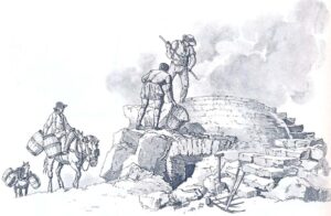
Old engraving of lime burners at work C1800.
Kiln Size and Operation
Kilns varied in size, reflecting their purpose and ownership. A kiln producing lime for use on a single farm, such as those around Bee Nest Farm, did not require a large bowl volume. Individual farmers would have baulked at the expense of constructing something larger than was needed. An estate kiln, such as the one in Casterton Woods near Casterton Hall (kiln 1) supplying all its tenants with agricultural lime or lime mortar for buildings may well have produced lime throughout the year, the kiln would necessarily have been much larger in every dimension.
Small ‘field’ kilns like those at Cragg House (kiln 7) or Caton House (kiln 6) tended to be worked only when lime was required. This may have been for the initial improvement of the newly enclosed moorland. Such kilns may have had a truly short lifespan.
On existing farmland, lime was applied either as top dressing on pastures or for treating land lying fallow, but only at intervals of anything from 10 to 20 years. In both scenarios a kiln would have been fired up and kept running on a continuous basis but only for as many weeks as were needed to complete this initial or cyclic process. For most of the time these kilns lay idle and, in their lifespan, only worked on an intermittent basis.[15]
The large twin kiln near Bullpot (kiln 8) and a third one close by (kiln 9) were for use of the public, as was the quarry, hence the twin kiln was larger and would allow one kiln to be fired while the other could be emptied of quicklime or refilled with limestone. Johnson noted that in Westmorland less than 2 per cent of surviving kilns have twin bowls.
‘Sow’ Kilns
Kilns prior to the late seventeenth century were not the masonry-fronted kilns surviving in the landscape today. They were built below the surface with bowls dug into a natural bank. By their nature, these older kilns now either lie buried and invisible or appear as an almost complete circular grass-covered hollow of a ‘sow’ kiln, with only the entrance to the old kiln breaking the perimeter.
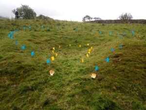
Photograph taken from the earthworks of a sow kiln at Pendragon Castle in Yorkshire showing the characteristic shape.[16]
Within the bowl of the sow kiln, the fuel such as wood, gorse, peat, or coal was layered with the limestone until there was a flattened dome level with the banks. This was then sealed with turves. There was usually a flue through the middle of the entrance of the kiln, which let oxygen in to feed the fire. The kiln was left, slowly simmering, depending on its size, for anything from 3 – 10 days. At the end of the burning, the was kiln dismantled by removing the turves and taking out the burnt lime.
This method of production gave lower quality lime, often contaminated with charcoal, but as its prime purpose was to improve the land this was not a problem.
There is no evidence of this type of kiln in Casterton or even Westmorland, but that does not mean that they did not exist. Every substantial building such as a church, bridge, manorial hall or castle would have required lime for its construction. In medieval times a small kiln -now lost- would have been constructed where it was needed and then dismantled or fell into disrepair.
Enclosures
The newly enclosed lands in the mid nineteenth century prompted a major impetus for improving the land. There was less incentive to develop the common land because many people had access to it. The new owner of enclosed land being the sole beneficiary suddenly had a motive to spend time and money improving the lands.
In July 1844, the Reverend William Carus Wilson gave evidence to a Select Committee of the House of Lords about his experience of Commons Enclosure. He was in no doubt as to the value derived from ‘liming’ the land. He told the Committee that when the land on Casterton Fell was enclosed, his father was allotted 400 – 500 acres. This was worth only about two shillings an acre. Nothing was done with the land until about thirty years later. At this point Wilson separated the higher part of his land -which he retained for shooting and grazing black faced sheep- from the lower part of the fell. The lower part was limed, at a cost of 50 – 60 shillings an acre. Wilson said that this was inexpensive an account of the proximity of limestone. Before the land could be limed it had to be cleared of heather and a large volume of stones which were thrown into ‘the ravines and hollow parts’. On the newly limed land it was possible to fatten cattle. Wilson reckoned that after the land had been improved it was worth 20 shillings an acre per year, a ten-fold increase.[17]
Uses of Lime
Johnson notes that farmers benefitted from using lime in other ways. As far as farmers were concerned lime had many uses, and not just for ‘sweetening’ acidic pastures, especially on newly enclosed moorland, or for replenishing the calcium content of soil on arable ground.
Several stock diseases were treated (with direct lime mixtures or by top dressing pastures), such as red water, lactation tetany and the degenerative bone disease Cochexia ossifraga. There was also a practice common to Westmorland and adjoining areas of Yorkshire, known as ‘need fire’, whereby cattle were driven through the smoke of a specially lit fire slowly enough for them to breathe in the fumes. Whether it was employed to treat cattle ‘murrain’ – which may have been foot and mouth – or in a superstitious attempt to keep ‘evil infections’ at bay is immaterial: those who used it believed in it.[18]
The Kilns Today
Next, I review the evidence for each of the probable 16 kilns in our parish. For each kiln I will review the historic records, the evidence on maps and where possible include photographs of the location of each kiln.
Kiln 1 – Casterton Woods
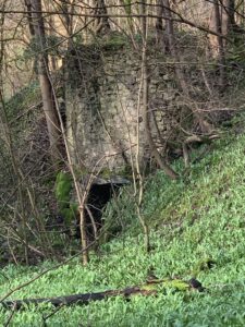
The kiln in Casterton Woods is still in good condition. Unfortunately, it is on private land, but it is possible to view it from a public path. The best view is in winter when the leaves screening it have fallen to the ground.
As can be seen from the photos below, the kiln is quite substantial in size.
There are limited references to kiln 1 in the public records. Given its proximity to the original Casterton Hall and/or its later C1796 replacement, it seems likely that it was part of the original Casterton Hall estate. An 1807 advertisement for letting the Casterton Hall Farm and Hole House (see below) makes reference to the farm formerly known as Casterton Hall having access to a lime kiln.[19] This former Casterton Hall is Old Hall (see previous Sketch for details).[20] The newer and current Casterton Hall was built about 10 years earlier.
Kiln 1 is Grade II listed on the National Heritage List for England which states ‘Limekiln. Probably C18 or C19. Coursed stone rubble with some plaster. Base has fire hole with canted sides. Upper part is recessed and rounded, with some plastering. Round charge hole.’[21]
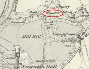
Extract of the 1862 OS map showing the location of kiln1.
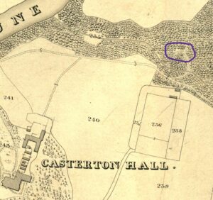
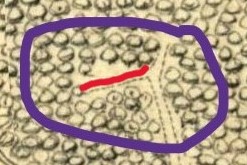
Extract from the 1843 tithe map showing the location of kiln 1 and in detail below, the footpath leading to it marked in red.
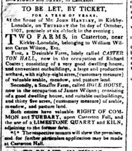
Advertisement from the Lancaster Gazette of 26 September 1807.
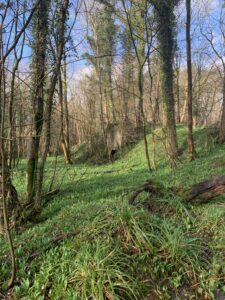
Above and below, the kiln 1 as it looks in 2024.[22]
Kiln 2 – Near Langthwaite Farm
Kiln 2 is located in a field next to where Bents Lane and Wandales Lane meet, just up the road from the railway bridge, and before you arrive at Langthwaite Farm.
The kiln is not recorded on the 1843 tithe map below, but I have added it, marked in green.
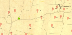
Extract of 1843 tithe map showing location of lime kiln 2 in green.
The kiln is clearly visible on the 1862 OS map. The map also shows that in the field opposite there are some old quarries.

Extract of 1862 OS tithe map showing location of lime kiln 2 in purple.
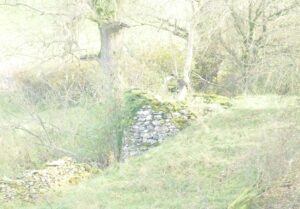
The kiln is Grade II listed on the National Heritage List for England which states ‘Limekiln. Probably C18. Stone rubble. Rounded structure built into slope facing north. Fire hole has corbelled jambs and lintel. Small hollow, probably originally quarry, adjacent.’[23]
The back side of the kiln can be seen from the road and the side profile from peering over the hedge from Bents Lane. Because it stands on private land, it is not possible to see the existing structure from the front. Johnson records it as complete.
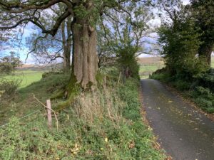
Location of kiln 2 near Langthwaite from lane leading to Langthwaite with detail below in 2024.
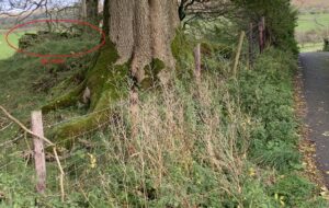
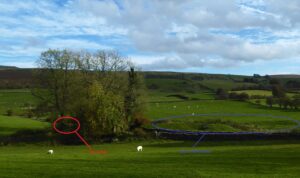
Location of kiln 2 and old Quarries near Langthwaite from Bents Lane with detail below in 2024.
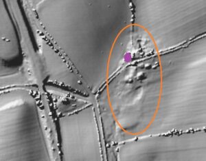
Lidar image showing location of kiln 2 in purple and the area of quarrying.
In an Indenture of conveyance dated December 1676 involving ‘Langthwaite within Casterton’, the document records that James Greenwood of Langthwaite was selling a farm to John Brockbank. Included in the sale was land referred to as ‘closes’, followed by their area in acres. Notably ‘the Banks’ – 7a, ‘Longer close’ – 7 acres, ‘Inge’ – 6 acres, ‘Hawkings acre’ – 2 acres, ‘Calf parrock’ – ½ acre, ‘Burreins’ – 3 acres, and 2 wheat parrocks on the backside of the house – 1 ½ acres, and buildings including an out house, a garden, hempland, 5 houses, 2 barns, 1 stable, 1 peat house, a kiln, horse miln. The selling price was £360. Sold separately was a close called Brackenrigg – 3 acres for £35.[24]
The existence of a kiln in the 1676 document does not necessarily mean it is the same kiln as kiln 2 noted above. A review of the field names on the 1676 document and compared with the 1843 Tithe map shows remarkable consistency across 140 years, as illustrated by the image below. Not only are the names the same, but the acreage is also very consistent showing that the field boundaries remained the same.

1843 tithe map marked with tithe map field names in red and the 1676 Indenture field names in green. The location of kiln 2 is shown in purple.
Kilns 3 and 13 – In the fields on the right of the road running from the crossroads at Lane End walking towards the church.
Kilns 3 and 13 are recorded as being part of Bee Nest in Johnson’s list. Of the four kilns noted as being associated with Bee Nest they are the most distant. Johnson indicates that there is no trace of them. I think that there might still be remains of kiln 3.
On the tithe map there is a path marked from the main road to the field where kiln 3 was. The small lane, marked in yellow in the 1862 OS map below is still there today and there are earthworks that could indicate the location of the lime kiln, marked in purple on the map.
The field name also confirms that there was a kiln there. Field names normally go back further than the nineteenth century. A field name mentioning a lime kiln suggest that it is older than the time of the Enclosures. The field name is ‘Sour Flatt Kiln’, number 156a on the tithe map.
The will of Robert Cragg who died in 1818, shows that at one time, he was the owner of kiln 3.[25] Robert’s first wife was Agnes nee Boak who died in 1784 aged only 36. They were married in 1769. Robert’s occupation at the time was as a Maltster.
When he wrote his will, Robert’s new wife was Elizabeth (nee Rawlinson), who he married in 1788. The beneficiaries of the will suggests that if Robert and Agnes had had sons, they were no longer alive. His two surviving daughters, both married, were Ann Briggs (born 1769/70) and Mary Carter (born 1779).[26] They were both named as a beneficiary to his estate as well as their stepmother Elizabeth, who was left an annuity of £21.
In the Will there is also mention of a Malt Kiln, after all Richard Cragg was a Maltster. I will write about this in a future sketch. Curiously, there is no specific mention of a lime kiln in the Will. This might indicate that by 1818, the old kilns were no longer considered sufficiently valuable to be worthy of including in the Will.
The Will does mention two fields which the tithe map shows contained lime kilns. By plotting the fields mentioned in the Will that Robert left to his daughter Mary Carter, it is clear that Robert Cragg lived at what is now called Holly Bush and he owned the fields surrounding it.
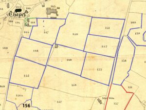
Extract of 1843 tithe map showing the fields outlined in blue and red mentioned in his 1818 Will.
His ownership of the house is confirmed with reference to the 1816 enclosure map which records that he was living there (see below). In those times when land was bequeathed to a married lady, in this case Mary, the law said that a wife was the husband’s chattel and could not herself own property. The inheritance therefore ended up belonging to her husband – John Carter, who she had married in 1800. John remained the owner and was recorded as such in the 1843 tithe records.
Mary’s sister Ann was bequeathed other parts of their father’s estate, ‘All other my Messuages Buildings, Lands Grounds, Tenements and Real Estate in Casterton aforesaid not herein before devised to the said Mary Carter I give and devise to my said daughter Ann Briggs’. Unfortunately, the Will does not go into more detail about what exactly was bequeathed.
As far as the fields with kilns in are concerned, Mary was given one called ‘Sour Flatt’, and another called ‘Lamb Parrock’.
On the tithe map there is a field called ‘Sour Flatt’ (155), but also two different and separated fields both called ‘Sour Flatt Lime Kiln’ (156a and 165). ‘Lamb Paddock’ or ‘Lamb Parrock’ as it was called in the tithe map, was field number 156.
As can be seen on the tithe map, field 156a -‘Sour Flatt Lime Kiln’– includes a kiln, kiln number 3 in this Sketch. In 1843 this field is owned by William Wilson Carus Wilson, as was field 155 – ‘Sour Flatt’.
The fields ‘Lamb Paddock’ (156) and the second ‘Sour Flat Lime Kiln’ (165), which also contained a kiln, number 13 in this Sketch, were still owned by John Carter.
It would appear that sometime after 1818, William Wilson Carus Wilson acquired some of the land from John Carter and shows that that either field 155 or 156 was divided to create 156a.
What we can be certain of is that kilns 3 and 13 were originally associated with Robert Cragg’s abode, now known as Holly Bush, and not with Bee Nest Farm.
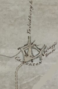
Extract of 1816 Inclosure Map showing ‘R Cragg’s House’. The map predates the church and school.[27]

1843 tithe map showing location of kiln 3 in field number 156a called Sour Flatt Lime Kiln.
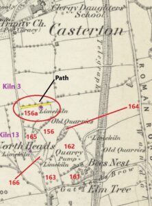
1862 OS map marked up to show tithe field numbers in red, the location of lime kilns 3 and 13 in purple, and the pathway to it in yellow.
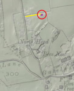
Combined LIDAR and OS map image showing location of kiln 3, path marked in yellow, kiln in purple.
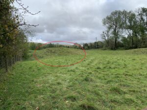
Possible remains of kiln 3.
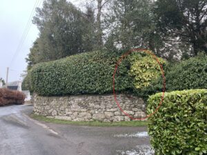
Approximate location of kiln 13 at entrance of North Heads.
Kiln 4 – North of Bee Nest
This kiln can be seen on both the tithe map and the 1862 OS map. The key difference between the two maps is the addition in the later one of the railway. The kiln is on private land. Johnson records that there is no trace of the kiln. Examining an aerial photograph confirms this, although the LIDAR image of the site does indicate remnants of the quarry.
The tithe map shows that field number 160 is called ‘Quarry and Kiln’. The owner of the field is recorded as Wilson William Wilson Carus Esquire. He was the father of the Reverend who founded the church and school.
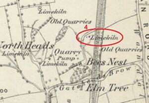
Extract from 1862 OS map showing location of kiln 4 marked in purple.
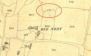
Extract from 1843 tithe map showing location of kiln 4 marked in purple.
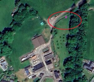
Aerial photo showing location of kiln 4 approximate position marked in purple.
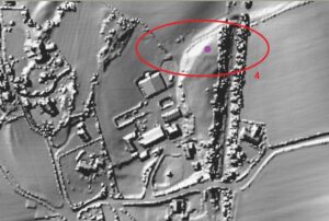
LIDAR image showing location of kiln 4 approximate position marked in purple.
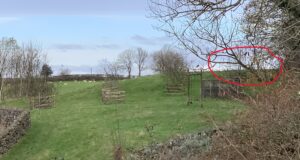
Photograph showing approximate location of kiln 4, probably over brow of hill.
Kiln 5 – North Heads
Kiln 5 was situated close by what is now the house known as North Heads. It appears clearly marked on both the 1843 tithe map and the 1862 OS map. It is only a few metres away from the previously mentioned kiln 13.
The tithe records show that kiln 5 was in field number 166 which was owned by ‘Pearson Francis & Pearson Alexandra Devises of the late Thomas Fenwick’ and rented by Deborah Braithwaite who lived in either what is now known as Rock Cottage or Lane Ends.[28] The field name was called simply ‘Parrock’.
Viewing the LIDAR map, there is no indication of any remains. Comparing a modern aerial photograph with the two maps helps pinpoint its location. Kiln 5 sits under a modern-day tree (see below).
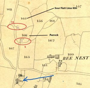
Extract of 1843 tithe map showing kilns 5 and 13, the kilns location in purple. The blue arrow points to Rock Cottage where Deborah Braithwaite was probably living.
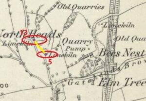
Extract of the 1862 OS map showing kilns 5 and 13. Note the path between the two, marked in yellow.
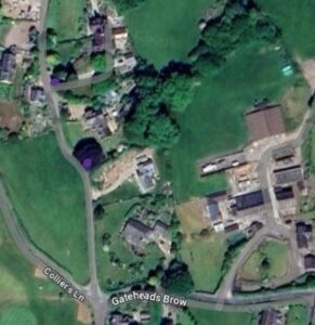
Aerial photograph showing approximate locations of where kilns 5 and 13 were.
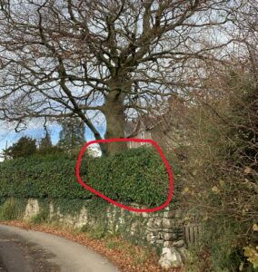
Approximate location of kiln 5 at foot of tree.
Kiln 6 – Caton House.
I have not yet researched the history of Caton House in detail. However, it is a very old house. Within its property boundary was kiln 6. The kiln does not appear on the 1843 tithe map. I think it would have been built at this time. It does appear on the 1862 OS map.
There is no trace of it to be seen on the LIDAR image. The site is next to the road, an inspection of which shows no identifiable remains.
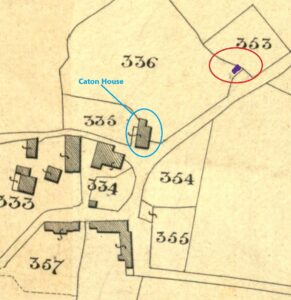
Extract of 1843 tithe map showing Caton House and added site of kiln 6.
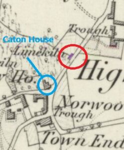
Extract of 1862 OS map showing Caton House and site of the lime kiln 6.
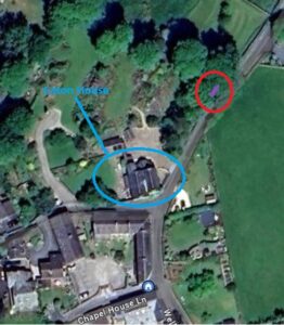
Aerial view showing Caton House and site of the kiln 6.
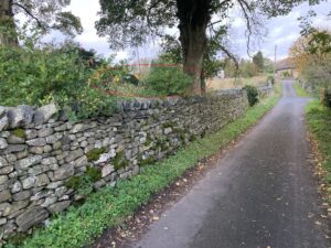
Above and below photographs showing approximate area of the now non-existent kiln 6.
Kiln 7 – Cragg House
Cragg House is another one of the oldest houses in High Casterton. I have not yet researched its history in detail.
The 1843 tithe map clearly identifies the kiln in field number 339 adjacent to Cragg House. The small field is named ‘Limekiln near Backside’ and is described as pasture. The house in plot 338 is referred to as ‘House and Garden’. Field 337 is called ‘Little Wood’. Allotment 340 is named ‘Escod & Cragg’. In 1843, the owner of the house was Ann Cragg. John Taylor was renting it.
Contradicting this, two years before, the 1841 Census records an abode called ‘Low House’, located in a place within the census record to indicate it was, what is now called Cragg House. Living in ‘Low House’ were the following occupants, Mary Atkinson aged 35, John Atkinson (20) and William Atkinson (10).
In 1845, a marriage announcement mentioned that John Roper of Cragg House, Casterton was marrying an Esther Robinson.[29] Roper may have been a tenant, perhaps replacing John Taylor who was there in 1843, who himself had replaced the Atkinsons who were there in 1841.
To add to the confused picture, the 1862 OS map still refers to the name of the house as ‘Low House’.
An 1879 advert for the sale of timber from the Cragg House estate suggests it had changed its name by then.[30] This may have been as a nod to the previous Cragg family who owned it rather than the geographical feature ‘crag’ which is normally spelt with just one ‘g’.
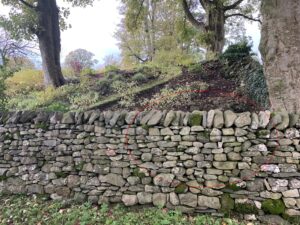
In 1899 an auction took place, including Cragg House, which was part of the larger Lunefield Estate sale. In the catalogue, no mention was made about the lime kiln. This suggests that it was no longer considered as a valuable asset. In the catalogue’s map of the estate, the field shown on the tithe map as number 339 has been subsumed into the one on the left-hand side numbered 342. On the auction catalogue this field was given the number 80 and was named ‘near Backside’.[31] LIDAR Imagery offers no hint of the site of the kiln 7.

Extract of 1843 tithe map showing Cragg House and the site of kiln 7.
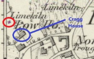
Extract of 1862 OS map showing Cragg House and the site of kiln 7.
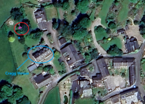
Aerial view showing Cragg House and approximate the site of kiln 7.
O/S
Photo showing the approximate site of kiln 7.
Kilns 8 and 9 – Bullpot
Kilns 8 and 9 are situated close to Bullpot Farm.[32] Kiln 8 is a twin kiln in particularly good condition. About 20 metres or so away is kiln 9 which is clearly visible but incomplete.
The twin kiln is Grade II listed on the National Heritage List for England which states ‘2 limekilns. Probably C18. Stone rubble. Square structures abut, facing east. Both have corbelled fireholes, now partly blocked, one with small central opening, the other blocked on right side.’[33]
The farm was established at the time of the Enclosure Awards in 1816. The enclosure map shows the site of Bullpot Quarry but predates the building of the farmhouse and the lime kilns.
After the Act for enclosing lands in the Manor of Casterton was passed, two Commissioners were appointed to collaborate with the local landowners to ensure that the conditions of the Act were correctly implemented. The Commissioners were Thomas Wakefield and Edmund Tatham.
Part of the implementation process involved advertising in local newspapers, advising the locals (those that could read anyway) what was planned. Referring to the area around Bullpot, the Commissioners wrote ‘One other Private, Carriage and Driving Road, of the width of Thirty Feet, commencing at the last mentioned Road near Bull Pot [Peat Road], and leading in a Southwardly direction over a certain part of Bull Pot Public Quarry Allotment, and over the lower part of Casterton High Fell, to the Public Lime Kilns, and [on] to an ancient Messuage called Hillet Scale, for the use of the owners and occupiers of Lands of Casterton, to this said Lime Kilns, and for the use of the owners and occupiers of the said Messuage called Hillet Scale, which we call the Hillet Scale Road.’[34]
The proposed allotments and roads were staked out and a map of the planned enclosures was deposited ‘at the Office of Mr Bradley, Solicitor, in Kirkby Lonsdale, for the inspection of all Persons interested.’
A meeting was to be held at ‘the House of Mr. James Roper, the sign of the ROSE AND CROWN in Kirkby Lonsdale’, on 13 June 1814, to allow people to object if they thought that what had been laid out was incorrect.
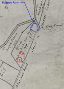
Extract of 1816 enclosure map showing area around Bullpot Quarry and marked with the site of where Bullpot Farm and where kilns 8 and 9 would later be built.
By the time of the 1843 tithe map, the kilns and Bullpot had been built and the surrounding fields given names. There was field number 500 called ‘Great Meadow including public Stone Quarries Meadow’, plot 501 named ‘Plantation’, allotment 502 called ‘Little Meadow’ and the plot number 503 referred to as ‘Homestead & Buildings’.
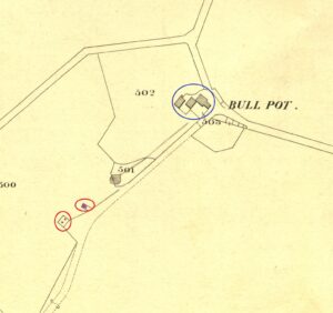
Extract of 1843 tithe map showing Bullpot Farm and kilns 8 and 9.
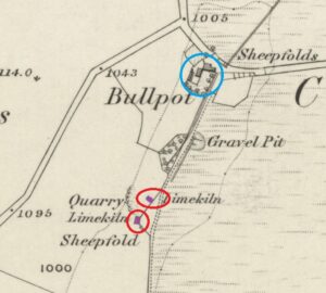
Extract of 1862 OS map showing Bullpot Farm and kilns 8 and 9.
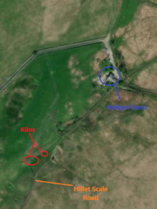
Aerial view of kilns 8 and 9, Hillet Scale Road and farm.
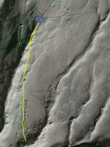
LIDAR Image showing Hillet Scale Road in yellow from Bullpot Farm and the many sunken pits from which coal or lime has been removed.
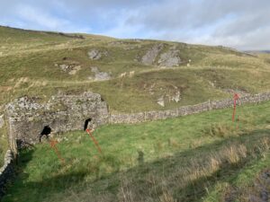
Looking east from Hillet Scale Road onto the twin kiln 8 and the third dilapidated kiln 9.
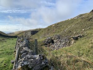
Looking west from Hillet Scale Road onto the dilapidated kiln 8 and beyond, the twin kiln 9.
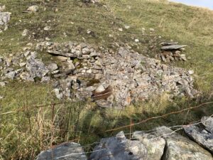
Close up of dilapidated kiln 9.
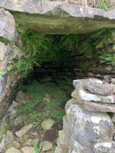
Close up of inside of one of the twin kilns.
Kiln 10 – East of Gale Garth
Kiln 10 is on private land, in a dip, and so not possible to view without the permission of the owner of the land. Johnson notes that it is a partial ruin. The kiln is not marked on the 1843 tithe map (field 490) but in that record the field name is ‘Limekiln Pasture’. The kiln is marked on the 1862 OS map.
There is a document in the Kendal Archives dated 21 October 1812 that includes details about a proposed sale of Gale Garth Farm by auction.[35] The proposal was that the auction would be held at James Batty’s house in Barbon, the person who owned the farm at the time. A newspaper advertisement for the auction noted that ‘There is a good Lime-kiln upon the premises, a good Limestone-quarry; also plenty of good coal within one mile.’[36] The kiln, kiln 10, was in the field called ‘Limekiln Pasture’ noted below on the tithe map, and in the 1863 loan document below. The successful bidder was Arthur Robinson.
Another proposed auction in 1846, which seemed not to have happened, indicates that ‘Limekiln Pasture’ was part of the Hillard Scale Farm rather than Gale Garth.[37]
On 7 November 1863, Thomas Robinson borrowed money from the Reverend Richard Mallinson from Melling and Robert Burrow from Whittington using Gale Garth Farm as security. The loan was for £1,000. The document stated that Robert Towers was the tenant and went on to describe the property. Which included ‘Lime Kiln Pasture (27a. 3r.)’ which at that time was part of the Gale Garth estate.[38]
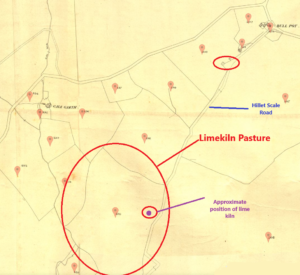
Extract of 1843 tithe map showing field number 490 called Limekiln Pasture.
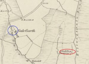
Extract of 1862 OS map showing location of kiln 10.
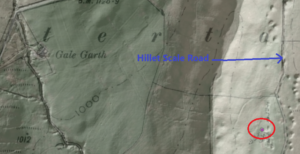
Combined Lidar and OS map showing location of kiln 10 and surrounding pits.
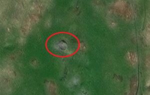
Aerial photograph showing partial remains of kiln 10.
Kiln 11 – East of Hillard Scale
Kiln 11 is located just east of the remains of Hillard Scale Farm. It was not recorded by Johnson in his survey of Casterton’s lime kilns, but it does lie within the Casterton parish border, albeit on the edge. The land on which the kiln was built did not form part of the 1816 enclosure and the kiln was not marked on the 1843 tithe map. It does however appear on the 1862 OS map. The field in which the kiln is located is number 508 in the tithe records with the name ‘Low Rigg’. The occupier of the land was not George Capstick who was farming these fields at the time and living at Gale Garth, but was recorded as Thomas Stockdale who was farming at Bullpot.
When I visited the site, there is no obvious trace of the remains of a lime kiln, and nothing can be identified visible looking at a LIDAR map or aerial view.
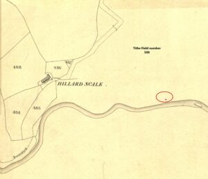
Extract of 1843 tithe map showing Hillard Scale Farm and the approximate location of kiln 11.
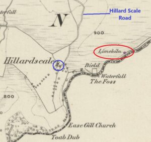
Extract of 1862 OS map showing Hillard Scale Farm and kiln 11. The dotted line is the parish border.
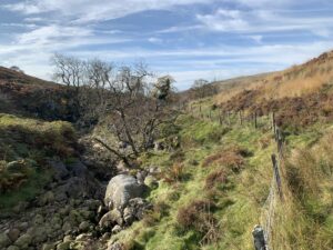
Approximate location of kiln 11 looking towards Hillard Scale. The dry riverbed is Leck Beck
Kiln 12 – Pearsett Park / Golf Course
Kiln 12 is on the edge of the garden of Pearsett Park and the golf course. Johnson noted that the site was visible but with no remains. No kiln is marked on the 1843 tithe map. The field in which the kiln is located is number 347 on the tithe map. It is called Pearsett after which the more recent house is named.
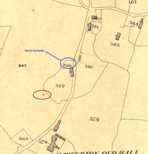
Extract of 1843 tithe map showing approximate site of the kiln 12. Note that this is before Newlands was built.
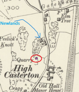
Extract of 1898 OS map which shows Newlands and the site of kiln 12.
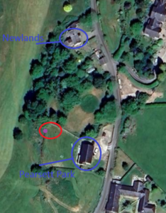
Aerial view showing approximate site of kiln 12.
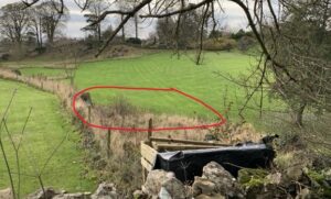
Photograph showing approximate location of kiln 12 overlooking golf course.
Kiln 13 – Near North Heads
See above under kiln 5
Kiln 14 – Barbon Border
Kiln 14 is a twin kiln on the Casterton side of the Barbon / Casterton border. Johnson did not record this. The kiln does not appear on either the 1843 tithe map or the 1816 enclosure map. It does however appear on the 1862 OS map of Barbon.
The kiln is Grade II listed on the National Heritage List for England which states ‘2 limekilns. Probably C18. Stone rubble. Square structures abut, facing north, that to west projects. Corbelled fireholes, that to east has asymmetrical opening, that to west has higher opening, now partly blocked.’[39]
The location of this kiln is remote. The nearest farm is Bullpot, but it would be strange if kiln 14 was associated with Bullpot due to the previously discussed kilns 8 and 9 close by. The 1862 OS map of Barbon also shows the existence of other lime kilns just across the riverbed in Barbon. This means that there were four kilns remarkably close to each other. Perhaps they were associated with an industrial centre rather than associated with a farm. Close to the group of kilns were two tracks, one that led north to Fell House Farm in Barbon some way away, and another heading north-west to Barbon Beck.
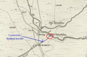
Extract of 1862 OS map of Barbon showing the site of twin kiln 14.
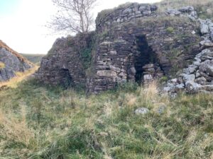
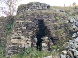
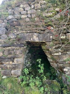
Twin kiln 14 looking northeast.

Twin kiln 14 looking northwest.
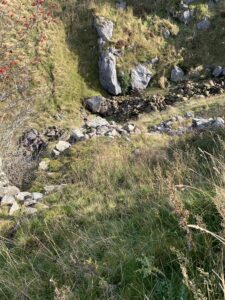
Looking down on top of twin kiln 14, and the dry bed of Aygill.

Inside the right-hand kiln 14.
The right side of kiln 14.
The left side of kiln 14.
Kiln 15 – The Vicarage
On a map of C1800 of the area around the church there is a field named ‘Kiln Croft’.[40] This field is the plot where Casterton Vicarage was later built, presumably around the same time that the Church which was built in 1833. The Vicarage was certainly completed on 12 May 1839 when a happy event occurred. ‘On the 12th Instant, at Casterton Parsonage, Westmoreland, the lady of the Rev. D. Barclay Bevan, of a daughter.’[41]
The Vicarage therefore should appear on the 1843 tithe map but was not updated on it, despite the Vicarage not appearing on the map, the written tithe record shows that field number 194 was now called ‘Parsonage and Gardens’.
The C1800 map indicates that at one time, a kiln may have existed in the field, although none is indicated on it.
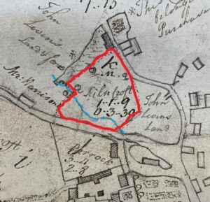
C1800 map of Casterton, field called Kiln Croft bordered in red with Casterton Beck in blue.
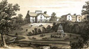
The old site of Kiln Croft, with Casterton Vicarage C1842 and Casterton School to the right.[42]

Extract of 1843 tithe map showing what was previously Kiln Croft but by then contained the Vicarage. Casterton Beck is shown in blue.

Extract of 1862 OS map showing the footprint of the original Kiln Close in which had been built the Vicarage.
Kiln 16 – Fell Gate also known as Fell Yeat or Fell Yate
Another C1800 map in the Kendal Archives prepared by John Todd shows the area around Fell Yeat Farm.[43] The farm is an ancient one. Records exists from as early as 1635 for this farm. Given its age, it is quite possible that the farm did at some time have a kiln, quite likely older than those in Casterton built at the time of the enclosures in 1816.
On that map there are three field names close to Fell Yeat which reference a kiln. Two of the fields are named ‘Kiln Parrock’ and one is called ‘Kiln Close’. I have annotated the map to allow a comparison of the fields and names with the later 1843 tithe map.
On that map, field 133 was named ‘Kiln Mire’ but on the C1800 Map it went by the name of ‘Kiln Parrock’. Field 126 was called ‘Kiln Parrock’ on both maps, whereas field 134 on the tithe map was called ‘Little Acre’ but on the C1800 Map named ‘Kiln Close’.
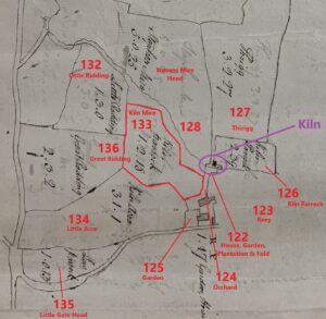
Annotated extract of C1800 map showing Fell Yeat Farm, the site of the kiln and in red, the tithe map field numbers and names.
On the C1800 map circled above in purple with detail below, shows what appears to be a building with possibly the kiln next to it.

Detail of C1800 map showing Fell Yeat Farm and the possible site of the kiln.
As shown below, there is no indication on later maps of the location of a kiln, although the building on the C1800 map can be seen on the tithe map, the 1862 OS map and can also be seen on modern aerial photographs.
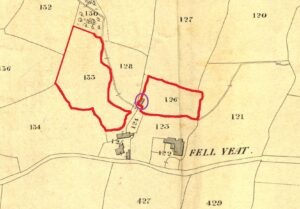
Extract of 1843 tithe map showing the fields Kiln Mire (133) and Kiln Parrock (126).
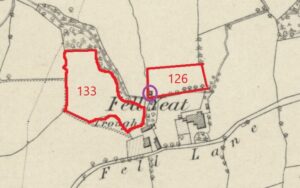
Extract of 1862 OS map showing Kiln Mire (133) and Kiln Parrock (126) fields and circled in purple the site of the kiln.
The LIDAR Map below does hint at a sunken structure adjacent to the building.
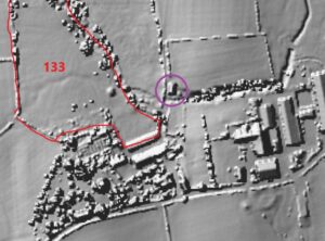
LIDAR image showing site of building and possible kiln site.
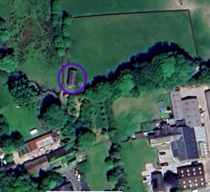
Aerial photograph of building.
Another Kiln?
In 1716, there was a conveyance between Edmund Hodgson of Westhouse in Thornton in Lonsdale and John Fairer of Casterton in Kirkby Lonsdale who was a ‘Waller’. The property being conveyed was ‘a messuage and onsett, one Kiln and a Malt House, also one dale lying on south side of the said messuage adjoining on the East to the lands of William Whittans, and on the west to the grounds of Roger Dodgson * * * containing by estimation one acre and three roods or thereabouts (be the same more or less). All within said premises are situated lying and being in Casterton aforesaid and held of the King by yearly rent of 8d.’ There was also ‘one brackendale’ in Casterton Fell Close. The consideration was £42 and 3 shillings.[44]
Unfortunately, I cannot place exactly where in Casterton this kiln and malt house was located but it may indicate the site of a now long-lost kiln. Alternatively, it may be the malt kiln noted above in the narrative of kilns 3 and 13.
Final Words
From the above, it is evident that Casterton had a remarkable number of kilns for such a small parish. Part of the reason for this was the ready supply of easily accessible limestone and deposits of low-quality coal on the fells.
Most of the kilns were associated with one of the old farms in the area, their main use probably to burn lime to improve the land. The kiln nearest Casterton Hall was likely also used to produce lime mortar, particularly when the new Casterton Hall was built C1796. There was the public lime kiln near Bullpot Farm and on either side of the Barbon border a group of kilns that were possibly for commercial production.
Simon Drakeford
November 2024
References
- Cumbria 1,000 years of maps, William D. Shannon, Jake Island Ltd, 2024 p116
- Source https://www.lakesguides.co.uk/html/maps/bo10.htm . Accessed 18 November 2024
- 1,000 years of maps, Shannon, p175
- 1,000 years of maps, Shannon, p172
- 1,000 years of maps, Shannon, p175
- Cumbria County Archives (Kendal), WPR 19/14/1/1 and WQ/RI/14 and others.
- Sourced from https://www.nationalarchives.gov.uk/help-with-your-research/research-guides/tithes/ .Accessed 25 October 2024.
- 1,000 years of maps, Shannon, p191
- Cumbria County Archives (Kendal), WDRC/8/250 a copy can also be seen behind a pay wall at https://www.thegenealogist.co.uk
- 1,000 years of maps, Shannon, p200
- Lime Burning and the Uses of Lime in the Historic County of Westmorland and Along the Pennine Edge of Cumberland, David S. Johnson, Transactions C&WAAS CW3, xiii, 2013, pp.191-213
- David Johnson, Lime Burning in Westmorland, Victoria County History of Cumbria Project, p9
- Lime Burning, Johnson, p200
- Lime Burning, Johnson, p200
- Lime Burning, Johnson, pp.204 – 5
- See https://www.yorkshiredales.org.uk/excavation-of-sow-lime-kiln-at-pendragon-castle/ .Accessed 31 October 2024
- Report From the House of Lords Select Committee on Commons Inclosure Vol XX, 1845, para 1643
- Lime Burning, Johnson, p196
- Lancaster Gazette, 26 September 1807, p2
- See https://www.castertonparishcouncil.org.uk/old-hall/
- Source https://historicengland.org.uk/listing/the-list/list-entry/1335936?section=official-list-entry Accessed 31 October 2024
- Photographs courtesy of the author. Unless otherwise stated, all modern photographs are taken by the author.
- Source https://historicengland.org.uk/listing/the-list/list-entry/1137462?section=official-list-entry Accessed 31 October 2024
- Cumbria County Archives (Kendal), WDCW/2/1/8/13
- Cumbria County Archives (Kendal), WDCW/2/4/2/4
- The Kirkby Lonsdale Parish Registers indicate that Robert and Agnes only had two children.
- Courtesy of Cumbria County Archives (Kendal), WQ/RI/14 Inclosure Award: Casterton Inclosure Award. Act: 1812 1816
- See my Sketch about Rock Cottage for more detail – https://www.castertonparishcouncil.org.uk/a-sketch-of-rock-cottage/
- Carlisle Patriot, 28 November 1845, p3
- Westmorland Gazette, 8 November 1879, p4
- Cumbria County Archives (Kendal), WDB/22/2/1/12
- I have written in detail about the history of Bullpot Farm in an earlier Sketch – see https://www.castertonparishcouncil.org.uk/a-sketch-about-bullpot-farm/ .
- Source https://historicengland.org.uk/listing/the-list/list-entry/1086901?section=official-list-entry Accessed 31 October 2024
- Westmorland Gazette, 29 May 1814, p1
- I have written in detail about the history of Gale Garth Farm in an earlier Sketch – see https://www.castertonparishcouncil.org.uk/a-sketch-about-gale-garth-farm/
- Lancaster Gazette, 3 October 1812, p2
- Westmorland Gazette, 5 September 1846. Also Auction Poster at Cumbria County Archives (Kendal), WDPP/2/4/98
- Cumbria County Archives (Kendal), WDWHELP/8/13
- Source https://historicengland.org.uk/listing/the-list/list-entry/1137562?section=official-list-entry Accessed 31 October 2024
- Cumbria County Archives (Kendal), WDCW/5/3 – High Casterton Hall [John Todd] – c.1800
- Saint James’s Chronicle, 16 May 1839, p4
- Helps to the Building of Churches, Parsonages, and Schools – 2nd edition, The Rev. W. Carus Wilson, M.A., A Foster, 1842
- Cumbria County Archives (Kendal), WDCW/5/11 – High Casterton Hall [John Todd] – c.1800
- Cumbria County Archives (Kendal), WDX 110/Bundle 1/T9